SOFT PINK AND YELLOW IRIS

SWEET WILLIAM

PRICKLY THISTLE BLOSSOM

TINY LITTLE SWEAT BEE

PLEASE ALWAYS REMEMBER THESE PHOTOGRAPHS ARE COPYRIGHT, Protected by United States Copyright and the Property of FranzsFeaturedFotos, Peggy Franz
SOFT PINK AND YELLOW IRIS
SWEET WILLIAM
PRICKLY THISTLE BLOSSOM
TINY LITTLE SWEAT BEE
PLEASE ALWAYS REMEMBER THESE PHOTOGRAPHS ARE COPYRIGHT, Protected by United States Copyright and the Property of FranzsFeaturedFotos, Peggy Franz
Well I got to capture the last of the Autumn Beauty Colors. I took a drive and visited several places. St. Genevieve Mo. Hawn State Park , Pickle Springs, Pickle Creek and Sandy Creek Cover Bridge as well as capturing a few things along the sides of the roads.
I am not ready for Old Man Winter yet,but I do like the beauty of the snow!!!

Along the Country side Road

This is in St. Genevieve Mo. at a roadside look out.


A capture of this abandoned farm with the wheat field

Pickle Creek Hawn State Park

Beautiful Reflection of Pickle Creek

The Old Dirt Farm Road

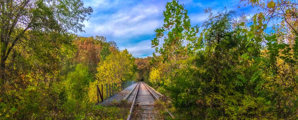
Sandy Creek Cover Bridge Fall Colors

Reflection Of the Sandy Creek under the Bridge

Reflections

We salute every soldier who’s served this great nation. And offer a heart of thanks and appreciation! I salute each member of our armed forces. And are thankful for their efforts and resources! I salute every son and daughter lost in a war. YOU are what serving this country is meant for!


This was taken on the Big River here in Missouri at the waterfall. I have several spots I go to capture my photography. Here is a little history
autumn peggy franz photos
The Big River is a tributary of the Meramec River in east-central Missouri. The river rises in western Iron County, near the summit of Johnson Mountain and the locale of Enough; it flows through Washington County, Saint Francois County, and Jefferson County. It forms part of the boundary between Jefferson County and Saint Francois County and also part of the boundary between Jefferson County and Washington County. It empties into the Meramec River opposite Eureka, where the Meramec forms the border between Jefferson County and Saint Louis County. The river flows through Washington State Park, St. Francois State Park, and the Lead Belt mining district. Like many other Ozark streams, the Big River has entrenched meanders; its valley is typically about half a mile wide, sometimes much narrower, and the valley is usually from 150 to 400 feet (46 to 120 m) deep.


IT’S ONLY A DREAM

On my 4th of July we took a road trip along Route 66 and it was fantastic! Here are some Memories of yesterday !So much good information on Times Beach, Coral Courts,Roadside Cafe, 66 Drive INN
Here is the History on Times Beach It was a really big deal! Now it os a beautiful Park called Route 66 Park. Lots of Wildlife and Nature, hiking ,trails for horses etc…
Times Beach is a ghost town in St. Louis County, Missouri, Missouri, United States, located 17 miles (27 km) southwest of St. Louis and 2 mi (3 km) east of Eureka. Once home to more than two thousand people, the town was completely evacuated early in 1983 due to a dioxin scare that made national headlines. It was the largest civilian exposure to dioxin in the country’s history.
Today, the land that was once Times Beach is now Route 66 State Park. One building from the town still exists: the park’s visitor center was once a roadhouse from Times Beach’s glory days, and was the EPA’s headquarters for the area. There is a large grass mound beneath which is the debris of the demolished buildings of the former town.[2]


My favorite time of the year to take photos of these birds is January through March. This are taking at Alton, Ill. and Grafton, Ill. That is were they migrate for the winter. This winter it was a mild winter, but they were still very active.

This is a Juvenile Eagle.


The adventure today was so incredible! Who new going out today hiking would take me through time. I laugh now because who knew that a 2 mile hike would feel like 10 miles because of the terrain. Boulders and rocks,cliffs and springs that were all over Crawling in and out , Through narrow rock walkways and cavelike walk ing paths with the coldest water dripping down. JUST BEAUTIFUL! YOU JUST NEVER KNEW WHAT WAS NEXT…
I will wake up tomorrow feeling my adventure lol… Here are some facts and some fun pictures of my hiking fun.


 This is a Natural Spring and ends up into this beautiful pond of crystal clear water.


IF YOU LOOK CLOSE IT ALMOST LOOKS LIKE A TURTLE


Almost forgot “Me” Crawling LOL:)
THE TOP OF THE MOUNTAINS !! MADE IT! YEAH!

I captured this on a road trip also. I am always looking for horses. They are my favorite. The one is looking at me saying,” WHAT” LOL.
http://www.franzsFeaturedFotos.wtsy.com

My love of Horses
